Wednesday, June 4, 2014

Keld June 4


We tried to start out early and not wake up Jean; but, she would not have it. What a kind woman. She made us lunches to bring on the trail. They consisted of a sandwich, orange juice, banana, potato chips, cake and candy. Enough food for two days and she wouldn't let us pay for it. It is no surprise that she rescues dogs and cats. The Manor House is a lovely place and very comfortable. The start was the easiest so far. We crossed the bridge and turned right on a paved path that had a finger post. Assisted by a compass, most of the trail was well marked. We walked up to the Nine Standards, which refers to nine rock pillars or cones. They are in the Pennines a little over 2000 feet. It then began to rain, not hard but consistent. The track was through bog county. Watching carefully your next step, often failures found your boot submersed in Peet goo. There is a lot of erosion so the park has three routes depending on the time of year. We did the Red route because it was May to July. We eventually descended into the valley which is beautiful and green. It is hard to believe that this is an area full of lead mines. The lead was first mined by the Romans and perhaps before them by Bronze Age man. At one point there were over 40 smelt mills. Today all you see is sheep. On reaching Keld we found our accommodations at the Butt House where we were greeted warmly by Jacqui. For dinner Chris served one sumptuous three course meal. The accommodations included a bath tub with very hot water were just what the body needs after a slog through the bog.


Thank you so much Jean
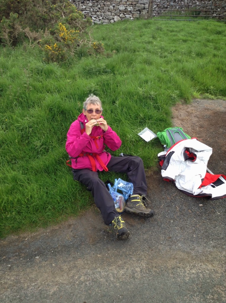
Eating The lunch provided by Jean

Early on footpath.

Early on the walk

On the way to the top.

Three of the Nine Standars.

Out of the wind, at the nine standards.

Seasonal paths. We took the Red route

Pennines Fell

Too many choices

Sheep hiding from rain

Long distant trail markers

Peet bog


Grouse Butt

Jack, Jill, Joan, Stu eating sumptuously. Shared misfortunes.
Jacqui and Chris, Absolutely, Lovely hostess and host and owners of the Butt House. Web www.butthousekeld.co.uk


Stu uses MotionX-GPS on the iPhone and is sharing with you the following track:

Half Way

Name:Keld
Date:4 Jun 2014 7:19 am
Map:
(valid until Dec 1, 2014)
View on Map
Distance:11.6 miles
Elapsed Time:7:26:35
Avg Speed:1.6 mph
Max Speed:4.1 mph
Avg Pace:38' 35" per mile
Min Altitude:532 ft
Max Altitude:2,193 ft
Start Time:2014-06-04T06:19:29Z
Start Location:
Latitude:54º 28' 24" N
Longitude:2º 20' 48" W
End Location:
Latitude:54º 24' 14" N
Longitude:2º 10' 00" W


Tuesday, June 3, 2014

Kirkby Stephen June 3

We had a good breakfast at The Barnhouse before we left. The Barnhouse is a beautiful converted Barn. It took 30 years to make all the changes. The hospitality from Judith and Peter was brilliant. We set off in the rain determined not to get lost because our good friend George was meeting us half way. Needless to say we missed our turn and ended up quite far from the Coast to Coast path. Fortunately we met another dog walker that told us we were at Crosby Garrett and a goodly distance off the C2C. She directed us back on track. Along the way we met two other English tourists in a car that were also lost. We kept walking and at the top of a hill we met another dog walker. She told us we had a way to go but to steady on for at least we were walking toward KS. We continued to leave George updates using an incorrect phone number. Again up another hill and at the top we saw a railroad bridge and thought at last we are on the right path. A farmer came by and laughed and said we were way off the track for the Smardale Bridge; however, Kirkby Stephens was just 2 miles straight ahead. He also commented that many get dislocated and more signs should be made available. A short time later, we met a couple from Scotland that showed us a reserve formed by an old railroad bed cut through Limestone where Orchids grow. He showed us the tiniest ever fly orchid. He used binoculars to show Joan who was on her hands and knees. We finally got to town. Our last message to George was to meet in front of The Black Bull Hotel. No George. We hung out for an hour and then went to our accommodation at the Manor House. Jean received us with hot buttered fruit bread and beverage. We called George's wife and she told us he was on the way after walking some 6 hours to meet us. What a friend. We met at the Manor House and had our reunion at the Kings Arms Hotel.


Judith and Peter

Living room

The Barn House

Finally a blanket to sleep under

A real bathe.


Missleading wall

Field of flowers.

You figure this on out.

Entry into town

The Manor House, finally


Just a trifle reward


Stu uses MotionX-GPS on the iPhone and is sharing with you the following track:

Lost Again!

Name:Kirkby Stephen
Date:3 Jun 2014 8:39 am
Map:
(valid until Nov 30, 2014)
View on Map
Distance:12.5 miles
Elapsed Time:5:25:36
Avg Speed:2.3 mph
Max Speed:4.1 mph
Avg Pace:26' 02" per mile
Min Altitude:545 ft
Max Altitude:1,079 ft
Start Time:2014-06-03T07:39:25Z
Start Location:
Latitude:54º 27' 54" N
Longitude:2º 34' 46" W
End Location:
Latitude:54º 28' 21" N
Longitude:2º 20' 56" W


Monday, June 2, 2014

Orton June 2


Orton

Of course, the first place you visit when arriving in Orton is the Chocolate Factory where we had sandwiches for a late lunch and Joan ordered up some chocolates to send home. The walk started off with a sad farewell to John and Janet owners of the Bampton Village Store and B&B. Service beyond reproach: Always with cheerfulness. May their business flourish. Thank you so much.

The early morning walk through fields of flowers was followed by the endlessness of the moors. We passed the Shap Abbey which was built in 1200. When Henry the Vlll closed all the Abbeys in the 1500's the Abbey was closed. It is a spectacular setting right on a river near a forest. A lot of the stones in the Abbey were used by people in the village. We continued on towards Orton. Very poor signage led us to believe we had no idea where we were. Upon stepping across a Cattle grate, we spotted a woman training a spaniel. Ingrid has be training other peoples' dogs for years, Ingrid-grayling.com is her web site. When asked she pointed the way by saying you just keep walking up hill and at the top the road takes you down to Orton. The distance just 4 miles including our first intermittent rain fall.

We are now in The Barn House. Scones and jam were laid out for us. What a life.


The Bampton Village Store and B&B.

John

John and Janet thank you so much.


Joan at the Chocolate Factory.

The Barn House at the end of the lane.

Stu uses MotionX-GPS on the iPhone and is sharing with you the following track:

Chocolate factory


Name:Orton
Date:2 Jun 2014 8:01 am
Map:
(valid until Nov 29, 2014)
View on Map
Distance:14.4 miles
Elapsed Time:6:30:02
Avg Speed:2.2 mph
Max Speed:4.1 mph
Avg Pace:27' 06" per mile
Min Altitude:581 ft
Max Altitude:1,168 ft
Start Time:2014-06-02T07:01:42Z
Start Location:
Latitude:54º 33' 24" N
Longitude:2º 44' 59" W
End Location:
Latitude:54º 28' 07" N
Longitude:2º 35' 01" W


Sunday, June 1, 2014

Bampton Grange June 1


Today was our last day in the Lake District. This was our farewell with a final high level climb. This was the highest climb we did on the Coast to Coast. We left Graham and Lynn the managers at the School House B&B. They are a delightful couple. They served a delicious breakfast and offered helpful advise about today's stage. They made sure we had plenty of water and fruit. Off we went for our adventure. The climb was steady up to Angle Tarn. We gained height rapidly until we arrived at Kidsty Pike a little more then 2500 feet. This was the top with views in all directions from Ennerdale Water to Riggindale, where England's last Golden Eagle is suppose to nest. We may in fact have seen it flying above our head. We saw a heard of deer cross the pass below us. For us the hard part was just beginning. The down slope was steeper a extremely gullied. At times we sat on our bottoms to reach a foot purchase. We ended up at the shore of Haweswater reservoir. There was a town and a farm here until it was flooded to form a reservoir for Manchester. As you walk along the lake you can see the rock walls ending under water. We walked a little over 5 miles along the lake and then inland towards Bampton where we had accommodations at the Bampton Village Store and B&B. Not only did we have a sunny day but we ended in a very hospitable B&B. Although it was late, Janet went out of her way to wash our clothes. We did not want a late dinner at the hotel, so she fixed us delicious sandwiches, salad, chips and cake. The real joy of the day, was soaking in a Stu length tub. We are looking forward to the very different trails ahead. We certainly will never forget the challenges of the Lake District.


Lynn and Graham at The Old School House

Lynn and Graham


Roman High Road

Beginning of Haweswater reservoir.

Path along Reservoir

Stu uses MotionX-GPS on the iPhone and is sharing with you the following track:

A real buster concluding LD


Name:Bampton Grange
Date:1 Jun 2014 7:32 am
Map:
(valid until Nov 28, 2014)
View on Map
Distance:12.6 miles
Elapsed Time:7:32:08
Avg Speed:1.7 mph
Max Speed:6.1 mph
Avg Pace:35' 48" per mile
Min Altitude:480 ft
Max Altitude:2,578 ft
Start Time:2014-06-01T06:32:35Z
Start Location:
Latitude:54º 32' 08" N
Longitude:2º 56' 13" W
End Location:
Latitude:54º 33' 24" N
Longitude:2º 45' 05" W