Monday, May 26, 2014

Carlisle May 26


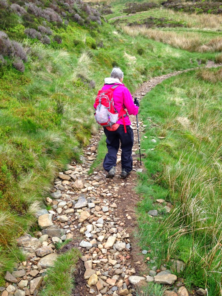
We got up early and went down to the bar to answer email and try to download the pictures to our blog. The wifi upload strength still wasn't enough. We will be successful in Carlisle, a city of 70,000. Stu had a full English breakfast to see if he could eat it all. Cereal, juice, fruit yogurt, toast and coffee followed by eggs, potatoes, ham, bacon, sausage, mushrooms and a tomato. The only thing missing was a pint of lager. He decided since it was a flat walk of 15 miles we could leave a little later and eat a solid breakfast. We were fortunate to meet Ann and Fran along the way. They are apart of a group of 8 Australian women doing the walk. The oldest we heard was 82. Ann took the lead. We were very happy to just follow and let another younger and more competent navigator take over. For a good part, the path followed the Cald beck then the River Caldew. We past through pastures filled with endearing lambs, forest and fields. The final four miles was a Tarmac cycle way. It being a national holiday many were out walking their dogs. Mostly Jack Russell terriers and flat code retrievers, that are gorgeous. They are black red setters. We passed Rose Castle, built in1230. It was destroyed in1314, rebuilt and destroyed again. Finally fortified and rebuilt in 1355. It has been the home of the bishop of Carlisle until 2009. It was used by the RAF in WW2. On reaching Carlisle we went to get our train tickets for tomarrow and then of course to the Apple Store to ask directions to the Cambor House.


The English Breakfast


Gara and Sue from Australia


A little sustenance.

Flowers abound

Giving a lecture at a Mill race.


Stu uses MotionX-GPS on the iPhone and is sharing with you the following track:

Flat terrain

Name:Carlisle
Date:26 May 2014 8:36 am
Map: (valid until Nov 22, 2014)View on Map
Distance:14.4 miles
Elapsed Time:5:37:13
Avg Speed:2.6 mph
Max Speed:4.2 mph
Avg Pace:23' 22" per mile
Min Altitude:50 ft
Max Altitude:657 ft
Start Time:2014-05-26T07:36:52Z
Start Location:
Latitude:54º 44' 54" N
Longitude:3º 03' 04" W
End Location:
Latitude:54º 53' 07" N
Longitude:2º 56' 11" W


Sunday, May 25, 2014

Caldbeck May 25


We had an early breakfast which Hunters Way was kind enough to leave out for us. At 06:30 we left the house and went down town to take some pictures of Keswick. The Cambria Way begins about a mile from the house. The first 4 miles is a climb. It is a good path with lovely views. The walk ends at a hostel called Skiddaw House. You then transfer to rugged morelands where there is a faint path which you follow for about 3 1/2 miles. Then the real trouble begins. The next so called path is described as "the next kilometres are steep, awkward and wet with no proper path. You may have to use your hands as well as feet in places and you will find it very slow going." It was all of that and some. Probably the hardest climb we have ever done. When you get to the top you can see a sleeping hut called Lingy hut. We met a hiker that came from the local area and he gave us some encouragement. From the hut the climb to the summit, High Pike, brought us great relief knowing it was all down hill. The views from the peak of the Lake District were spectacular. Two worn out old fellows finally arrived at the Oddfellows Arms Pub where a room waited. Stu immediately had a pint of beer, lamb cobbler and salad. After walking all day with the sheep, it didn't seem right but it was certainly good. During the walk, rain threatened but fell in the surrounding valleys on all sides of us.


Stu uses MotionX-GPS on the iPhone and is sharing with you the following track:

Name:Caldbeck
Date:25 May 2014 6:14 am
Map:
(valid until Nov 21, 2014)
View on Map
Distance:15.8 miles
Elapsed Time:10:21:51
Avg Speed:1.5 mph
Max Speed:6.6 mph
Avg Pace:39' 25" per mile
Min Altitude:253 ft
Max Altitude:2,166 ft
Start Time:2014-05-25T05:14:48Z
Start Location:
Latitude:54º 35' 55" N
Longitude:3º 07' 54" W
End Location:
Latitude:54º 44' 53" N
Longitude:3º 03' 07" W

Hours are way off, only 8 hours


Saturday, May 24, 2014

Keswick May 24.


We decided to leave early before breakfast because we had 16 miles to go and the description of the Trail was. Steep and arduous fell paths both ascending and descending , requiring careful navigation. Since our navigation skills over the last two days have gotten us lost, the more time we have for the walk the better. The hotel, The Old Dungeon Ghyll, left us some cereal which we ate before leaving. We spent a good night in a beautiful room so we were ready. Fortunately the trail started behind the hotel but from that point on we did not find one marker for the CW. We ascended slowly because the path was very rocky both on the flat and climbing the mountain The views were spectacular and the trail up was tiring. It was 7.3 miles up and down the mountain to the first town of Rosthwaite. That took us almost 4 hours. The second part of the trip into Keswick is about 8.2 this was easier but we were tired by then. There were footpaths and lakeshore walking paths all the way to Keswick which is a busy tourist town. This weekend is a 3 day holiday so the place was jammed with people. We found our accommodations at Hunters Way. It too is lovely place. Once established, we went out to find the beginning of tomorrows walk which is about 1 mile from Hunters Way. On our way back we stopped for some delicious cauliflower soup and warm bread. Back here for shower and rest.


To check the strengths of WiFi signals download app Ookla

Stu uses MotionX-GPS on the iPhone and is sharing with you the following track:

Name:Keswick
Date:24 May 2014 6:24 am
Map:
(valid until Nov 20, 2014)
View on Map
Distance:14.3 miles
Elapsed Time:7:17:26
Avg Speed:2.0 mph
Max Speed:4.5 mph
Avg Pace:30' 41" per mile
Min Altitude:241 ft
Max Altitude:1,578 ft
Start Time:2014-05-24T05:24:38Z
Start Location:
Latitude:54º 26' 43" N
Longitude:3º 06' 10" W
End Location:
Latitude:54º 35' 58" N
Longitude:3º 08' 11" W


Friday, May 23, 2014

Old Dungeon Ghyll Hotel May 23


We had a pleasent stay at the Black Bull Inn and Hotel. We started the day with a modified English Breakfast just cereal, fruit, and toast. It is way too difficult to walk when you have stuffed yourself with eggs, sausages, ham, tomatoes and mushrooms etc. We looked over the town of Coniston before we left. It is the home of the Midsummer Murders which we are addicted to. The town is small maybe 2 blocks with all the essential services plus a couple of inns, holiday homes, caravan parks and even a Sailing Club. It is situated on a lake and is very popular during the summer.

We then set off for a relatively easy day only 11 miles which of course turned into 12.3 because we lost the trail and walked off the trail for a bit. The scenery is gorgeous all covered in green with lots of wild flowers. May is the perfect time to come here because of the flowers and it is lambing time. The fields are covered with baby lambs and their mothers. They have lambs that are born black and as they get older they turn an off white. They are so cute. It seems that everyone has at least one dog. All the pubs say dogs and muddy boots are welcome.

We did better with the trail signs today until the end. Either the trails are better marked or we are getting better at reading the signs. It is very confusing at times because we cannot always understand the directions. The scenery is beautiful. The lakes, streams, rivers, mountains and fields blend together peacefully.

The Hiking Bar at our hotel just served us an half of chicken plus a robust helping of fries. Our hotel, Old Dungeon Ghyll Hotel, is located in a valley with its back against one fell, mountain, looking across at another.


Stu uses MotionX-GPS on the iPhone and is sharing with you the following track:

Name: Old Ghyll
Date: 23 May 2014 9:04 am
Map:
(valid until Nov 19, 2014)
View on Map
Distance: 12.3 miles
Elapsed Time: 6:16:55
Avg Speed: 2.0 mph
Max Speed: 4.6 mph
Avg Pace: 30' 42" per mile
Min Altitude: 151 ft
Max Altitude: 708 ft
Start Time: 2014-05-23T08:04:42Z
Start Location:
Latitude: 54º 22' 10" N
Longitude: 3º 04' 17" W
End Location:
Latitude: 54º 26' 43" N
Longitude: 3º 06' 10" W