Saturday, May 31, 2014

Patterdale May 31

After a lovely night and breakfast at Chestnut Villa we started our walk. A surprise awaited us at breakfast when we got an email from our friend George Gossling. He is a dear walking buddy that walked with us on two Caminos in Spain. He must have read about our mishaps along the trail yesterday and decided to drive all the way up to the Lake Country and meet us half way between Grassmere and Patterdale. We started as quickly as we could leaving a note for Chris and Alma, yesterday's rescuers, to tell them we were off and on the trail. Today's stage is the shortest of our stages only 7 miles. It was short but once again views at every corner. We could see the gorgeous green valley with the lake of Ullswater in the distance. The trail was good and up we went and George, the black knight, was waiting at the top. Together we walked to Grisedale tarn, a beautiful mountain lake. One more mile and we came upon a hut for walkers called Ruthwaite Lodge. We ambled down into the valley and finally into Patterdale, a small village no more then a meandering collection of houses with a pub where we had a lovely lunch with our friend, George. After he left for home, we took a short walk to see where tomorrow's trail begins. Returning to The School House where Lynn, the manager, offered us hospitality and warmth.


Jennings Pub for dinner with Chris and Alma

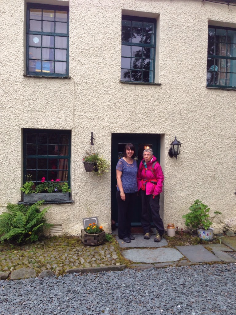
The Chestnut Villa B&B.

Bags on left delivered by air full of rocks for placement.

The seemingly endless path.

Joan waiting for Stu to catch up.

Maintenance of paths always ongoing.

George and Joan excited to reconnect

The Ruthwaite Lodge

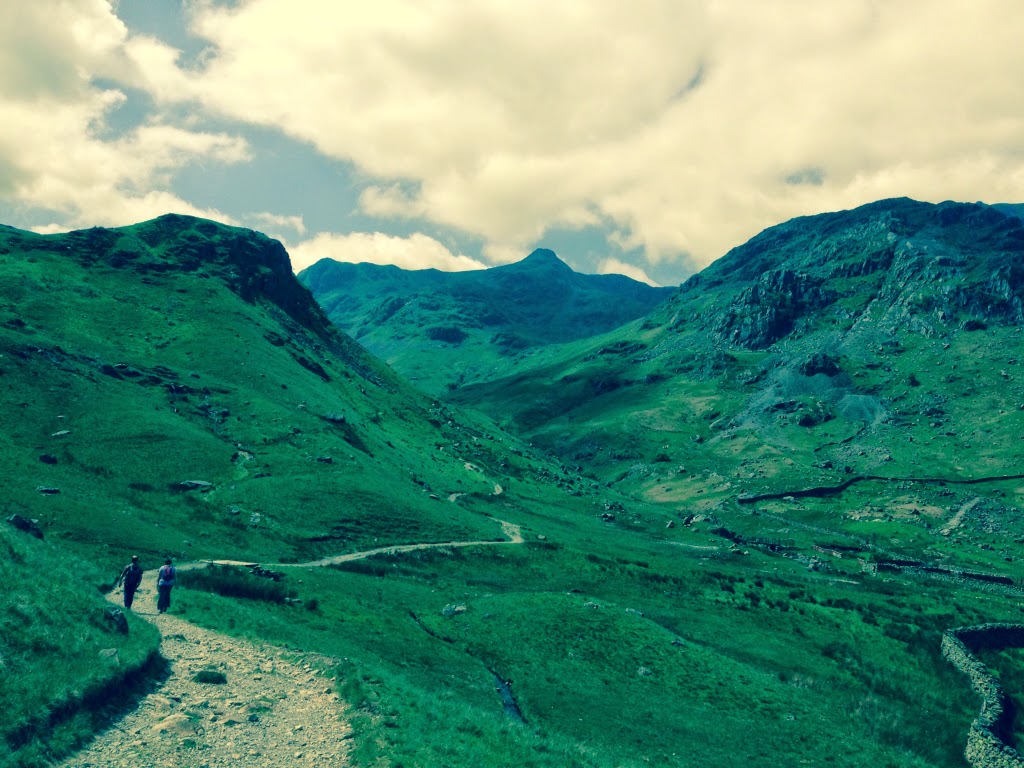
The trail to the top

English garden with invasive rhododendron.

The White Line Pub. Lunch with George.

The Patterdale Country Store

The Old School House

Stu uses MotionX-GPS on the iPhone and is sharing with you the following track:

George joined us


Name: Patterdale
Date: 31 May 2014 8:33 am
Map:
(valid until Nov 27, 2014)
View on Map
Distance: 7.05 miles
Elapsed Time: 4:59:52
Avg Speed: 1.4 mph
Max Speed: 4.5 mph
Avg Pace: 42' 31" per mile
Min Altitude: 271 ft
Max Altitude: 1,931 ft
Start Time: 2014-05-31T07:33:19Z
Start Location:
Latitude: 54º 28' 09" N
Longitude: 3º 01' 27" W
End Location:
Latitude: 54º 32' 04" N
Longitude: 2º 56' 01" W


Friday, May 30, 2014

Grasmere May 30


We left our beautiful accommodation at Thorneythwaite Farm. It is a working sheep farm. Joanne and Jonnie run the farm and the B and B. Joanne has decorated the place beautifully and sent us off with a delicious breakfast. Today's track was only 9 miles and we thought we would be in by noon. We dragged in around 1600. It was a tough slog up the Stonethwaite Beck, Greenup Gill to the Greenup Edge. We continued on the correct path doubting we were right. Stuart fell and broke his walking stick. We walked back down to the Edge. Alma and Chris and Michael were just starting up. We asked for directions. This was Chris and Alma's third Coast to Coast. We spent the rest of the day following them and managed to find Grasmere. It seemed the hardest walk so far. The trail was very rocky, slippery and boggy. Stu fell 3 times, Chris twice. We were very happy to see level ground and get into Grasmere. I purchased new poles, we hit the bakery and then the grocery store for chocolate and beer. For dinner we joined Chris and Alma at the best Pub in town. They will be our companions for the rest of the journey. We are now tucked away in our rooms at Chestnut Villa, another very attractive B&B.


Joanne and Joan at Thorneythwaite.

Thorneythwaite Farm

Crossing Over to our trail at Stonethwaite.

Stu enjoys standing in old telephone booths

Postal box labelled GS. Many years older than Joan

The trail is like this for extended periods of time.

Finally at the top.

Michael from Milwaukee. He camps out!

Alma and Chris, who saved us.

Where is the trail?

Someone payed the stones, Thank you.

The Team arriving in Grasmere.

Wainwright Hotel, Gosmere

Stu uses MotionX-GPS on the iPhone and is sharing with you the following track:

Name:Grasmere
Date:30 May 2014 8:33 am
Map:
(valid until Nov 26, 2014)
View on Map
Distance:9.04 miles
Elapsed Time:7:02:58
Avg Speed:1.3 mph
Max Speed:4.2 mph
Avg Pace:46' 47" per mile
Min Altitude:225 ft
Max Altitude:2,011 ft
Start Time:2014-05-30T07:33:50Z
Start Location:
Latitude:54º 30' 37" N
Longitude:3º 09' 59" W
End Location:
Latitude:54º 27' 32" N
Longitude:3º 01' 30" W


Tuesday, May 27, 2014

Ennerdale Bridge May 28


We walked the path back where we left off our walk yesterday at the railroad tunnel. We walked under the tunnel and over a farm track. We had some problems navigating this area but eventually we found the markers and a good trail around More Row. It was at this time we met Jo, a New Zealander. We walked with her along the paths and up to our first real high point, Dent Fell at 1000 feet. Here we met 2 Austrailian women that joined us on our climb. It is about 1000 feet up. It was a gradual climb. At the top the views are breathtaking and here is where we met another walker and she is from the Netherlands. The hardest part is coming down which is very steep. It is recommended that if it is wet to slide down on your backside. Down we went arriving at a spectacularly beautiful beck. We followed this lovely river trail into Ennerdale. Bridge. We had lunch at the pub of scampi and chips and cod and chips. Sue and Liza the waitresses went out of there way to get our coats dryer and to get in touch with Roselly the B and B owner.. We were to early to get into our B and B so we walked Jo down to the lake called Ennerdale Water. It is the most westerly lake in the Lake District National Park. We then walked her along the lake for a bit. She then set off to her camping barn. We walked back and came to our B and B a beautiful place called Thorntrees. It is owned by Rosaleen and Billy. We got a warm welcome and a cup of tea.


Jo and Jo, from New Zealand

Climbing over a deer fence.

Steepest downhill on the C2C

Joan heading for a beautiful valley walk.

The Northern route around Ennerdale Water

B&B Ennerdale.

Pub at Ennerdale

Stu uses MotionX-GPS on the iPhone and is sharing with you the following track:

Name:Ennerdale Bridge
Date:28 May 2014 7:56 am
Map:
(valid until Nov 24, 2014)
View on Map
Distance:8.37 miles
Elapsed Time:5:02:56
Avg Speed:1.7 mph
Max Speed:4.2 mph
Avg Pace:36' 10" per mile
Min Altitude:45 ft
Max Altitude:1,157 ft
Start Time:2014-05-28T06:56:10Z
Start Location:
Latitude:54º 30' 40" N
Longitude:3º 34' 21" W
End Location:
Latitude:54º 31' 45" N
Longitude:3º 26' 31" W


Monday, May 26, 2014

St Bees May 27


We had time to transition from the CW to the C2C. During our day off, we wandered around the extensive shopping area of Carlisle, the hub being the train station. We purchased tickets for St Bees on the 1150 train. The Cambro House is operated by Alice and Dave. Alice and Joan laughed together over stories told. We have consistently enjoyed the warm and friendly B&B owners welcome.

We visited the Cathedral at Carlise, still standing stronger and proud after 900 years. The cathedral was founded 1122. Stain glass date from the 14th to 20th century. As we waited for our train to leave, we sat in a small park watching the business of people.

The train arrived at St Bees on time. It was such a short walk to Stonehouse Farm B&B we almost walked by it looking for it. Tony met us at the door. Because

Tony told us that we could walk the first 6 miles today and then take a path back to St Bees by a 11/2 mile path along the railroad. We could then walk back tomorrow to where we left off and this would save us 6 miles, We decided to do this. It starts down at the beach of St Bees at the Irish Sea where we wet our boots in the sea and picked up two stones to carry to the North Sea. It was an exhilarating stroll along sea cliffs to the light house and the coastguard station. You then walk inland through pastures and small towns until we arrive at a railroad tunnel our starting point the next morning. From here we took the path through sheep fields back to St Bees.


St Bees first meal

St Bees herself

The headland start

A beginning

Looking back at St Bees, Irish Sea

Along the cliff

Kissing gate

Stu is tired already

To the trails ahead

Looking back at the Cliff walk.