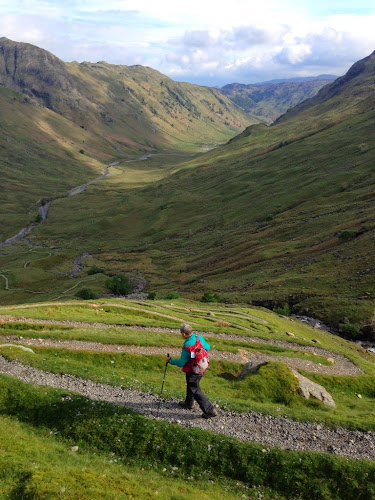
We decided to leave early before breakfast because we had 16 miles to go and the description of the Trail was. Steep and arduous fell paths both ascending and descending , requiring careful navigation. Since our navigation skills over the last two days have gotten us lost, the more time we have for the walk the better. The hotel, The Old Dungeon Ghyll, left us some cereal which we ate before leaving. We spent a good night in a beautiful room so we were ready. Fortunately the trail started behind the hotel but from that point on we did not find one marker for the CW. We ascended slowly because the path was very rocky both on the flat and climbing the mountain The views were spectacular and the trail up was tiring. It was 7.3 miles up and down the mountain to the first town of Rosthwaite. That took us almost 4 hours. The second part of the trip into Keswick is about 8.2 this was easier but we were tired by then. There were footpaths and lakeshore walking paths all the way to Keswick which is a busy tourist town. This weekend is a 3 day holiday so the place was jammed with people. We found our accommodations at Hunters Way. It too is lovely place. Once established, we went out to find the beginning of tomorrows walk which is about 1 mile from Hunters Way. On our way back we stopped for some delicious cauliflower soup and warm bread. Back here for shower and rest.
To check the strengths of WiFi signals download app Ookla
Stu uses MotionX-GPS on the iPhone and is sharing with you the following track:
| Name: | Keswick | |
| Date: | 24 May 2014 6:24 am | |
| Map: (valid until Nov 20, 2014) | View on Map | |
| Distance: | 14.3 miles | |
| Elapsed Time: | 7:17:26 | |
| Avg Speed: | 2.0 mph | |
| Max Speed: | 4.5 mph | |
| Avg Pace: | 30' 41" per mile | |
| Min Altitude: | 241 ft | |
| Max Altitude: | 1,578 ft | |
| Start Time: | 2014-05-24T05:24:38Z | |
| Start Location: | ||
| Latitude: | 54º 26' 43" N | |
| Longitude: | 3º 06' 10" W | |
| End Location: | ||
| Latitude: | 54º 35' 58" N | |
| Longitude: | 3º 08' 11" W | |


No comments:
Post a Comment