We had a pleasent stay at the Black Bull Inn and Hotel. We started the day with a modified English Breakfast just cereal, fruit, and toast. It is way too difficult to walk when you have stuffed yourself with eggs, sausages, ham, tomatoes and mushrooms etc. We looked over the town of Coniston before we left. It is the home of the Midsummer Murders which we are addicted to. The town is small maybe 2 blocks with all the essential services plus a couple of inns, holiday homes, caravan parks and even a Sailing Club. It is situated on a lake and is very popular during the summer.
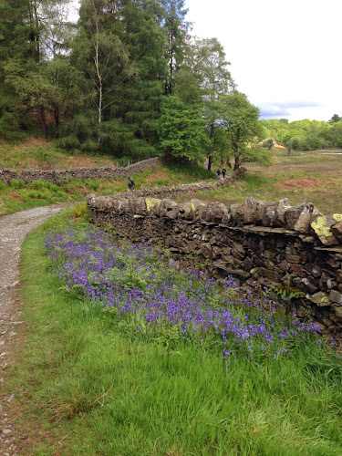
We then set off for a relatively easy day only 11 miles which of course turned into 12.3 because we lost the trail and walked off the trail for a bit. The scenery is gorgeous all covered in green with lots of wild flowers. May is the perfect time to come here because of the flowers and it is lambing time. The fields are covered with baby lambs and their mothers. They have lambs that are born black and as they get older they turn an off white. They are so cute. It seems that everyone has at least one dog. All the pubs say dogs and muddy boots are welcome.
We did better with the trail signs today until the end. Either the trails are better marked or we are getting better at reading the signs. It is very confusing at times because we cannot always understand the directions. The scenery is beautiful. The lakes, streams, rivers, mountains and fields blend together peacefully.
The Hiking Bar at our hotel just served us an half of chicken plus a robust helping of fries. Our hotel, Old Dungeon Ghyll Hotel, is located in a valley with its back against one fell, mountain, looking across at another.
Stu uses MotionX-GPS on the iPhone and is sharing with you the following track:
| Name: | Old Ghyll | |
| Date: | 23 May 2014 9:04 am | |
| Map: (valid until Nov 19, 2014) |
View on Map | |
| Distance: | 12.3 miles | |
| Elapsed Time: | 6:16:55 | |
| Avg Speed: | 2.0 mph | |
| Max Speed: | 4.6 mph | |
| Avg Pace: | 30' 42" per mile | |
| Min Altitude: | 151 ft | |
| Max Altitude: | 708 ft | |
| Start Time: | 2014-05-23T08:04:42Z | |
| Start Location: | ||
| Latitude: | 54º 22' 10" N | |
| Longitude: | 3º 04' 17" W | |
| End Location: | ||
| Latitude: | 54º 26' 43" N | |
| Longitude: | 3º 06' 10" W | |


No comments:
Post a Comment